-40%
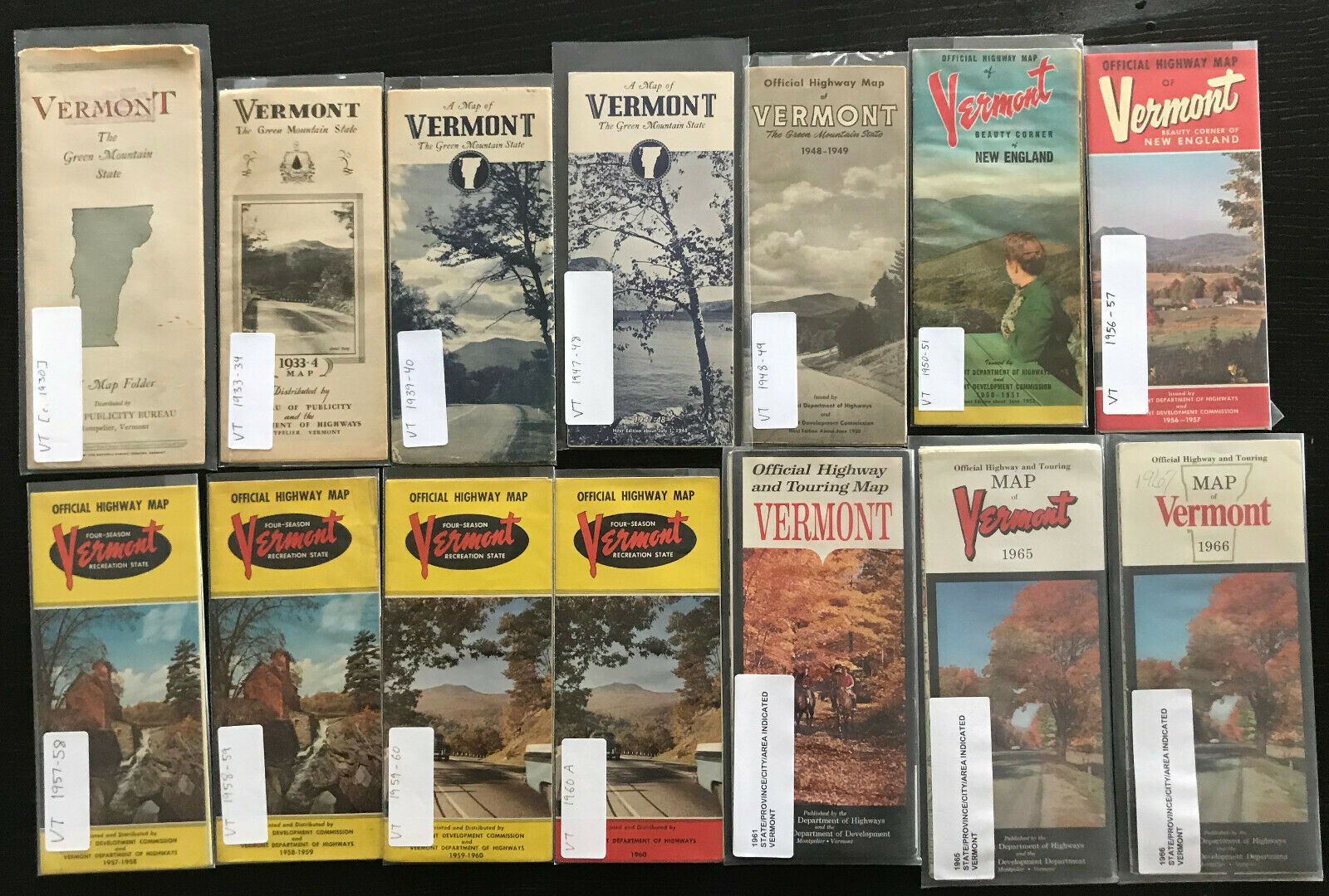
Collection of 43 Official Vermont State Roadmaps
$ 31.15
- Description
- Size Guide
Description
Collection of 43 Official Road Maps issued by the Vermont State Department of Transportation.All maps come in a labeled protective sleeve.
Maps are graded:
GOOD - Map is good condition, no obvious defects
FAIR - Map is in a good condition, but has one or more of the following defects noted below:
POOR - Map is not in good condition, with one or more of the following defects.
- Tear - A small tear or rip
- Mis-fold - At some point the map was not folded back properly
- Pinhole - At a fold point, map has pinhole wear gaps
- Writing - Writing on map, which does not affect quality of map
- Worn - Map is well worn (used)
If more than one map was issued in the same year, the variant is labeled as an A or B.
[c. 1930] - not dtd (literature refers to planned 1930 bridle path system completion); red & green txt and st outl map - GOOD
1933-34 - dtd cvr; bw photo of paved road 'Camels Hump' - FAIR PinHole
1939-40 - dtd back cvr; blue tint bw photo of hwy, trees, & mtn - FAIR PinHole
1947-48 - dtd cvr; blue tint bw photo of lake in mtns - GOOD
1948-49 - dtd cvr; bw photo of rd in mtns - GOOD
1950-51 - dtd cvr; clr photo of woman at picnic table looking at view - GOOD
1956-57 - dtd cvr; clr photo of farm with mtns in distance - GOOD
1957-58 - dtd cvr; clr photo of bldg by small rocky stream - GOOD
1958-59 - dtd cvr; otherwise same as 1957-58 - GOOD
1959-60 - dtd cvr; clr photo of cars on hwy with mtn in bkgd - GOOD
1960 A - dtd cvr; same photo as 1959-60 (Dept. of Hwys) - GOOD
1961 - dtd lgnd; clr photo of man & kids on hill above village - GOOD
1965 - dtd cvr; clr photo of car on road in autumn - GOOD
1966 - dtd cvr; different title on top - FAIR Writing
1967 - dtd cvr; clr photo cars on divided hwy - GOOD
1968 - dtd cvr; clr photo of divided hwy - GOOD
1970 - dtd cvr; clr photo of farm in autumn - GOOD
1971 - dtd cvr; clr photo of cows with village in bckgrd - GOOD
1972 - dtd cvr; clr photo of girl by red house on gravel rd - GOOD
1973 - dtd cvr; clr photo of hills in autumn from across lake - GOOD
1975 - dtd cvr; clr photo of farm in autumn - GOOD
1976-77 - dtd cvr; clr photo of people playing in lake - FAIR PinHole
1978-79 - dtd cvr; clr photo of red barn by water - GOOD
1980-81 - dtd cvr; clr photo of boat at sunset - GOOD
1982-83 - dtd cvr; clr photo of white church - GOOD
1984 - dtd cvr; otherwise same as 1982-83 - GOOD
1985-86 - dtd cvr; clr photo of village in spring - GOOD
1987-88 - dtd cvr; clr photo of boy jumping off covered bridge - GOOD
1989-90 - dtd cvr; clr photo of yellow houses and wildflowers - GOOD
1991 - dtd cvr, lgnd (1991-92), cprt (1990); clr photo of farms, 'Bicentennial Edition' - GOOD
1995 - dtd cprt; clr photo of red covered bridge in autumn - GOOD
2000 - dtd cvr; highway past farm - GOOD
2002 - dtd cprt; otherwise same as 2000 - GOOD
2003 - dtd clr; color photo barn and church. Attractions map - GOOD
2004-05 - dtd cvr; clr photo man by lake at sunrise/sunset - GOOD
2006 - dtd lgnd (5/06); 4 clr photos (State capitol, syrup, farm field in fall, hiking in snow) - GOOD
2007 - dtd lrhc of map (5/07); clr photo of bicyclist on road by farm - GOOD
2008 - dtd lrhc of map (4/08); clr photo of couple walking on curving road - GOOD
2009 - dtd lrhc of map (4/09); clr photo of barn and silos - GOOD
2010 - dtd lhrc of map (5/10); clr photo of farm on hill with deer in field - GOOD
2012 - did lrhc of map (5/12); clr photo of road through autumn trees - GOOD
2013 - dtd lrhc of map (5/13); clr photo of red covered bridge - GOOD
2015 - dtd lrhc of map (5/15); clr photo cows in front of covered bridge - GOOD


